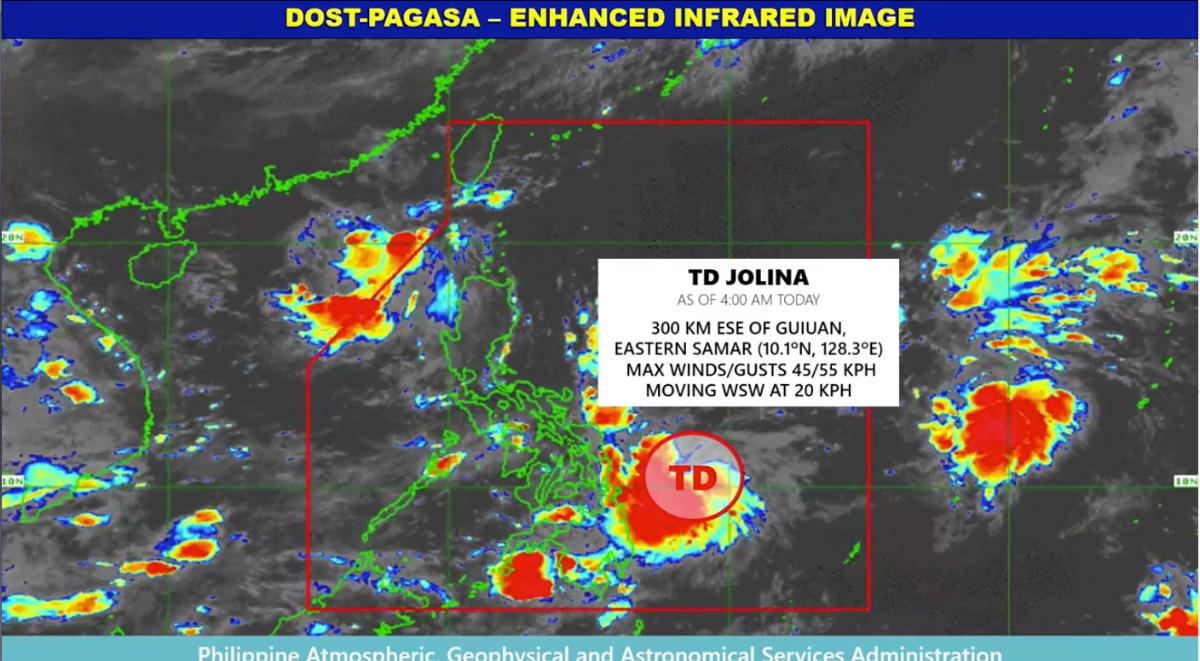
(GMA News) Seven areas were placed under Tropical Cyclone Wind Signal No. 1 before noon Monday as Tropical Depression Jolina slightly intensified as it moved westward over the Philippine Sea.
In its 11 a.m. report, PAGASA said under TCWS No. 1 are:
Sorsogon
Northern Samar
Samar
Eastern Samar
Dinagat Islands
Siargao Islands
Bucas Grande Islands
PAGASA said Jolina may likely intensify into tropical storm by Wednesday.
“The highest possible TCWS that will be raised throughout its passage will be TCWS #2,” it said.
Jolina is seen to make landfall over Northern Luzon by Thursday morning before moving westward while traversing over Northern Luzon. It may re-emerge over the West Philippine Sea by Thursday evening and exit ng Philippine Area of Responsibility by Friday morning.
“However, the public is advised to continue monitoring for possible changes in the track forecast in the succeeding bulletins,” PAGASA said.
As of 10 a.m., Jolina’s center was estimated based on all available data at 205 km east southeast of Guiuan, Eastern Samar or 230 km east northeast of Surigao City, Surigao del Norte (10.4°N, 127.5°E). It is packing maximum sustained winds of 55 km/h near the center, gustiness of up to 70 km/h, and central pressure of 1004 hPa.
Eastern Samar, Dinagat Islands, and Surigao del Norte, including Siargao and Bucas Grande Islands, should expect moderate to heavy rains in the next 24 hours due to Jolina, PAGASA said… Read More
